Drone Roof Surveys
Detailed Aerial Survey Capturing all key areas for Accurate Assessment and Report
Drone Roof Surveys from £135+vat
For the first 45m² Roof area,
Included with Every Drone Survey
Report of findings and all image files are uploaded to secure cloud storage for you to view, download or share at any time. Access links are provided immediately after processing so you can get the information you need without delay.
For Quotes and Bookings Contact us below
Drone Roof Survey
Gain detailed insights into your roof’s condition with our advanced drone roof survey service. Using high resolution imaging and precision UAV technology, we deliver accurate, actionable data to help with maintenance planning, defect identification, and asset management.
How It Works
Our drone roof survey goes beyond a standard our inspection. Multiple high-resolution images are captured from varying elevations and angles, providing a complete visual record of the roof. When potential defects are identified, additional targeted imagery is collected to ensure all issues are thoroughly documented.
This method allows a complete assessment without the need for scaffolding, ladders, or manual access, significantly reducing risk while providing detailed results.
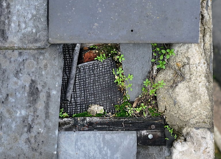
Areas Covered
The survey captures all major roof elements and ancillary structures, including:
Roof tiles, slates, membranes, and ridges
Valleys, hips, verges, and eaves
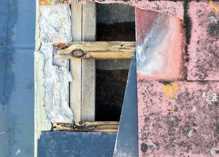
Leadwork, flashings, and soakers
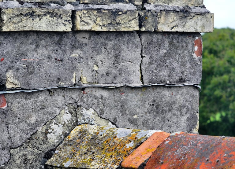
Chimney stacks, pots, and pointing
Gutters, downpipes, brackets, and fixings
Satellite dishes, aerials, and cable runs
This comprehensive coverage ensures that both obvious and subtle defects are identified and documented.
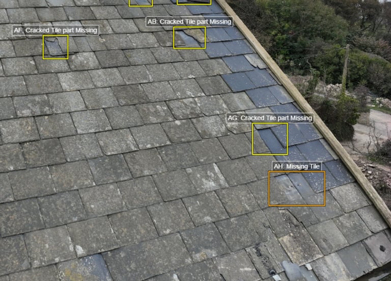
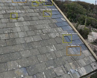
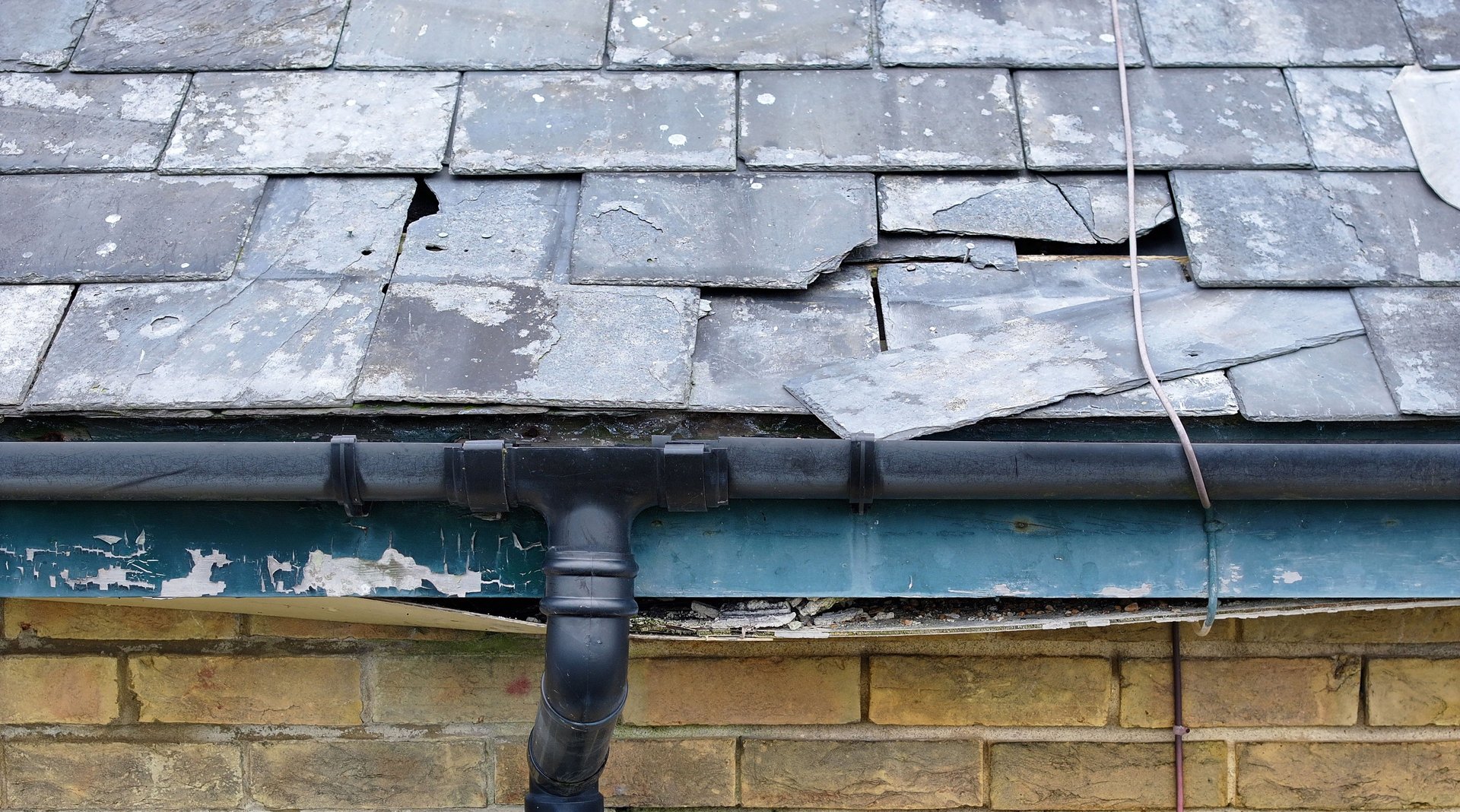
Defect Detection
Our high-resolution imagery allows for the identification of a wide range of roof defects, including:
Slipped, fractured, or missing tiles
Cracked or deteriorated mortar joints
Displaced ridge or hip tiles
Leadwork splits, corrosion, or lifting
Blocked, misaligned, or damaged gutters
Surface wear, mechanical damage, or signs of water ingress
Structural deformation, sagging, or misalignment
Every defect is mapped and referenced in the final report for clear location identification.
Reporting & Data Access
Following the survey, a detailed technical report is generated based on the collected imagery. The report includes:
A summary of findings and identified defects
High resolution images highlighting problem areas
Recommendations for maintenance or repair
Clear referencing to facilitate contractor or insurer review
All imagery and reports are uploaded to secure cloud storage, providing instant access, long-term documentation, and easy sharing with relevant stakeholders.
Benefits of Our Drone Roof Survey
High accuracy aerial data for precise assessment
Elimination of manual roof access and associated risks
Comprehensive coverage of all roof components
Permanent visual record for maintenance and compliance
Faster, safer, and more cost-effective than traditional surveys
Applications
Drone roof surveys are ideal for:
Property managers and building owners
Roofing contractors and maintenance teams
Insurance assessments and claims verification
Construction site monitoring
Historical building preservation and compliance reporting
Ensure your roof’s condition is fully documented and potential defects are addressed before they escalate.
Contact us today to schedule a comprehensive drone roof survey and receive detailed image data and a professional report for your property.